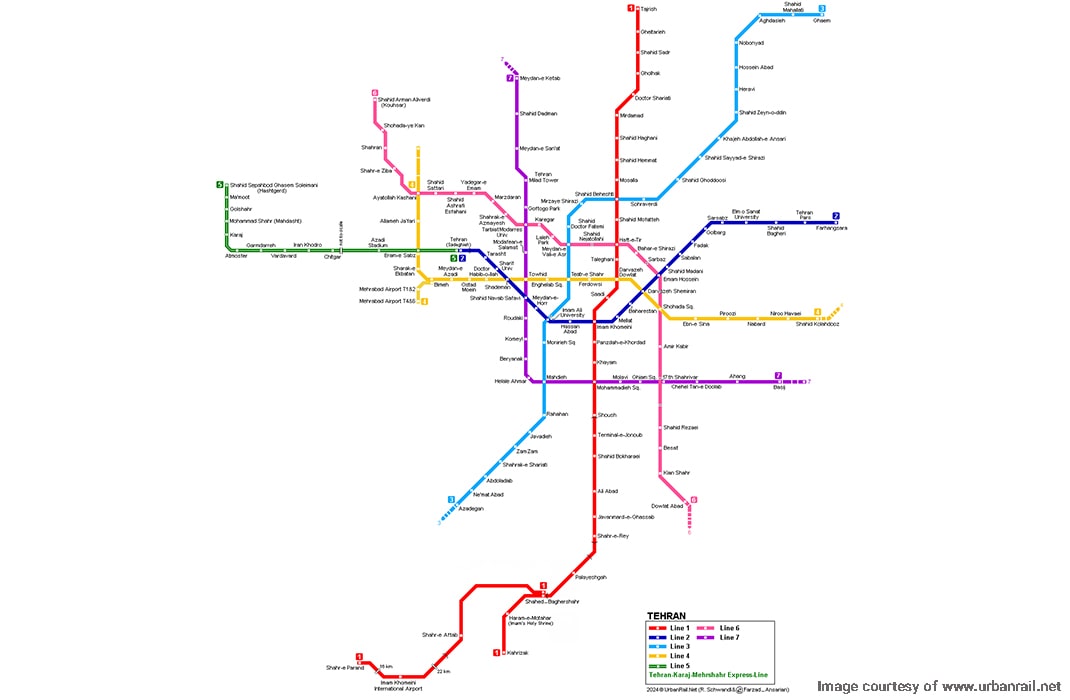
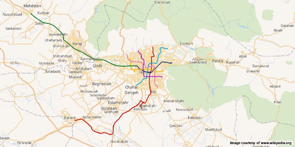
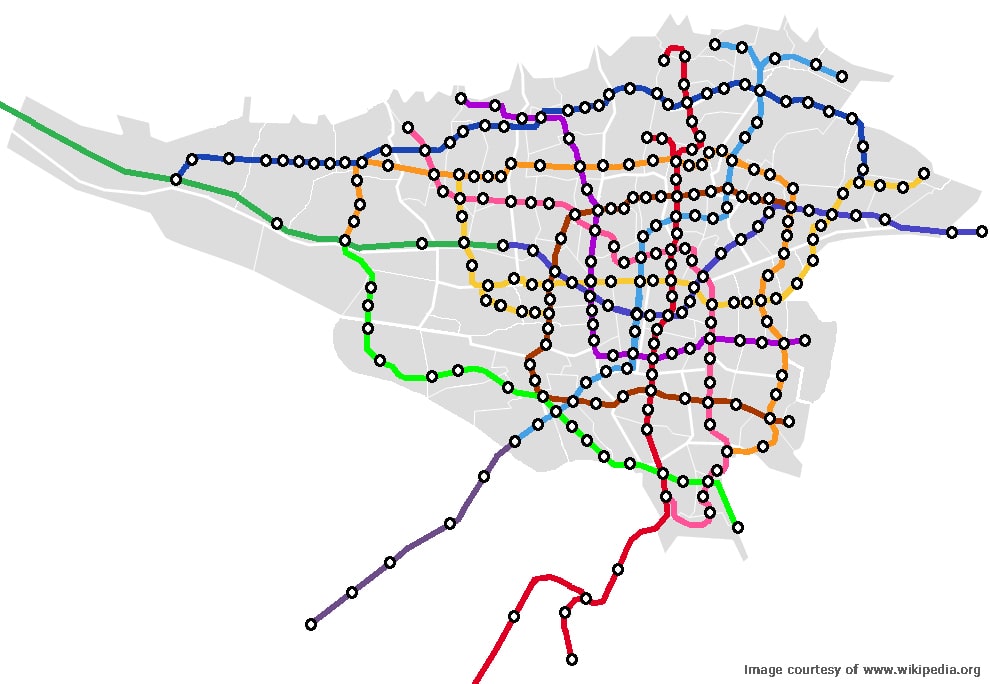
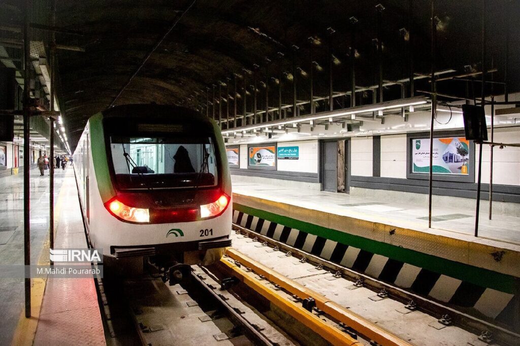
Tehran Metro System is the Middle East’s largest underground rapid transit system. It is one of the fastest, easiest, and cheapest ways to travel in Tehran. It covers 159 active stations with plans to add more to the system. The total track length is 296 km, with 221 km of urban and 75 km of suburban tracks. This mode of public transport helps more than 2.5 million people travel around Tehran daily. Tehran’s subway system can help travelers access many of Tehran’s tourist attractions across the Iranian capital.
History of Tehran Metro Map
The initial plans for building a subway system date back to the 1970s. The initial construction plans for the Metro were drawn up with the help of French architects. Construction started in 1978 but was halted after the 1979 revolution. The plan was forgotten until 1986 despite widespread opposition.
The initial plan was to establish 52 underground train stations connected via three subterranean tracks stretching over 90 km. The initial lines 1, 2, and 5 would connect Mirdamad—Imam Khomeini’s Shrine (North-South), Dardasht—Sadeghieh (east-west), and a suburban track from Tehran to Golshahr. The initial construction project ended in 1995. The next phase was the installation of equipment, which took four years.
Inauguration of Tehran Metro Lines
The first Tehran Metro line (Line 5) was inaugurated on March 7, 1999. Iran’s first commuter line connects Tehran to the Karaj suburbs. This line will be recognized as Express Line 1 in future Tehran Metro maps.
Line 2 was inaugurated in 2000, connecting Sadeshieh Station in southwest Tehran to Imam Khomeini Station in central Tehran. Line 1 became operational in 2001, connecting northern Tehran to Kahrizak in the south. Line 4 was inaugurated seven years later in 2008. It connected Kolahdooz in Tehran’s east to Ekbatan Town in western Tehran.
Line 3 became operational in 2012, connecting Ghaem in the northeast to Azadegan station in the southwest. Line 7 was inaugurated in 2017, connecting Sanaat Square in the northwest to Basij Highway in the southeast. Line 8 was inaugurated in 2019, and is supposed to connect Masoudieh Town in the southeast to the west and then Sarsabz Square in the east. This line is still under construction and partially operational.
Tehran Metro Map Expansion Plans
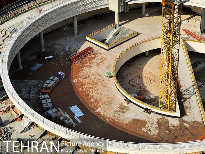
The construction of 5 new stations for Line 3 and 34 new stations for Line 8 is underway, in addition to 35 stations for the upcoming Line 10. Additionally, two new lines, Line 9 with 39 planned stations and Line 11 with 17 planned stations, are planned. Line 11 will connect Chitgar station to Eslam Abad in the southeast suburbs.
Three new commuter lines, connecting the central Metro system to suburban areas in Karaj and Hashtgerd, have been proposed. These LRT (light rail train) lines will further extend the Tehran Metro map.
The Tehran Metro system is a maze of stations connecting all important landmarks in Tehran. The subway allows you to reach all major tourist attractions rapidly. However, navigating the various lines can be tricky for new visitors. The following list of stations and interchange points can help you find your destination. Lines 1, 2, 3, and 4 include the most visited tourist attractions in Tehran, which we have listed below.
Tehran Metro Line 1
Line 1 is red on Tehran Metro maps. It is 87 km long and connects Tajrish station to Kahrizak and Imam Khomeini Airport stations. It has 32 active stations and has interchange stations with lines 2, 3, 4, 6, and 7. The stations include:
- Tajrish
- Gheytariyeh
- Shahid Sadr
- Gholhak
- Shariati
- Mirdamad
- Shahid Haghani
- Shahid Hemmat
- Mosalla
- Shahid Beheshti (interchange, Tehran Metro Line 3)
- Shahid Mofatteh
- Shohada-ye Haftom-e Tir (interchange, Tehran Metro Line 6)
- Taleghani
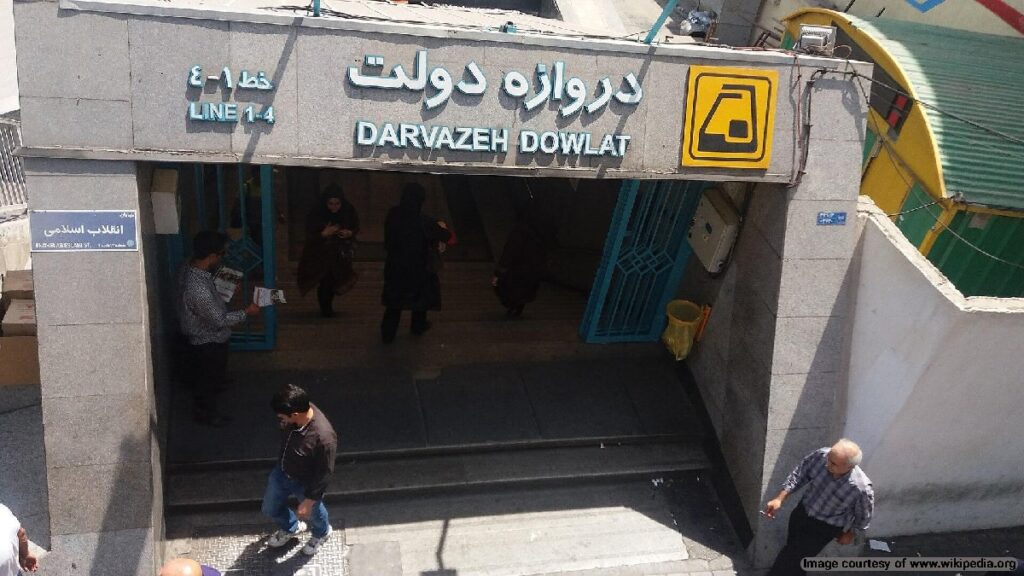
- Darvazeh Dowlat (connection, Tehran Metro Line 4)
- Saadi
- Imam Khomeini (interchange, Tehran Metro Line 2)
- Panzdah-e-Khordad
- Khayam
- Meydan-e Mohammadiyah (interchange, Tehran Metro Line 7)
- Shush
- Payane Jonoob (Bus interchange)
- Shahid Bokharaei
- Ali Abad
- Javanmard-e-Ghassab
- Varamin
- Shahr-e-Rey
- Tehran-South Depot
- Palayeshgah
- Shahed – Bagher Shahr
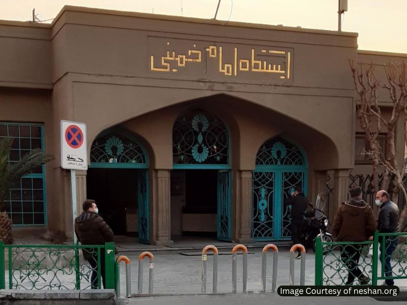
- Haram-e Motahhar (Imam Khomeini’s Shrine)
- Kahrizak
- Shahr-e Aftab
- Vavan
- Imam Khomeini International Airport
- Parand
Tehran Metro Line 1 Schedule
First Train: Departs Tajrish at 5:32 AM, and arrives at Kahrizak by 6:45 AM.
Last Train: Departs Tajrish at 10:02 PM, and arrives at Kahrizak by 11:15 PM.
Frequency:
- Peak Hours: ~5–10 minutes.
- Off-Peak: ~10–15 minutes.
- Late Evening: ~15–20 minutes.
Tehran Subway Line 2
Line 2 is dark blue on Tehran Metro maps. It is 23.4 km long and connects Sadeghieh to Farhangsara. It has 22 active stations and has interchange stations with lines 1, 3, 4, 5, 6, and 7.
Line 2 stations include:
- Tehran (Sadeghiyeh, Interchange with Line 5)
- Tarasht
- Daneshgah-e Sharif
- Shademan (Interchange with Line 4)
- Shahid Navvab-e Safavi (Interchange with Line 7)
- Meydan-e Horr
- Daneshgah-e Emam Ali (Interchange with Line 3)
- Hasan Abad
- Imam Khomeini (Interchange with Line 1)
- Mellat
- Baharestan
- Darvazeh Shemiran (Interchange with Line 4)
- Imam Hossein (Interchange with Line 6)
- Shahid Madani
- Sabalan
- Fadak
- Janbazan
- Sarsabz
- Elm-o-Sanat University
- Tehran-East Depot
- Shahid Bagheri
- Tehranpars
- Farhangsara (towards Pardis)
Tehran Metro Line 2 Schedule
First Train: Departs Imam Khomeini at 5:15 AM, and arrives at Shahid Beheshti by 6:30 AM.
Last Train: Departs Imam Khomeini at 9:45 PM, and arrives at Shahid Beheshti by 10:55 PM.
Frequency:
- Late Evening: ~15–25 minutes.
- Peak Hours: ~5–10 minutes.
- Off-Peak: ~10–15 minutes.
Tehran Metro Line 3
Line 3 is light blue (turquoise-colored) and 33.7 km long. It connects Ghaem station to Azadegan depot. It has 26 active stations and interchange stations with lines 1, 4, 6, and 7. It is also connected to the Trans-Iranian railway, Tehran’s bus network, and the BRT (Bus Rapid Transit) system.
Line 3 stations include:
- Ghaem
- Mahallati
- Aghdasiyeh
- Nobonyad
- Hossein Abad
- Heravi
- Shahid Zein-o-din
- Khajeh Abdollah-e Ansari
- Shahid Sayyad-e Shirazi
- Shahid Ghoddoosi
- Sohrevardi
- Shahid Beheshti (interchange with Line 1)
- Mirzaye Shirazi
- Meydan-e Jahad
- Meydan-e Vali Asr (interchange with Line 6)
- Teatr-e Shahr (interchange with Line 4)
- Daneshgah-e Emam Ali (interchange with Line 2)
- Moniriyeh
- Mahdiyeh ( interchange with Line 7)
- Rah Ahan or Tehran Central Station (interchange with Iran railway system, Bus, Bus rapid transit)
- Javadieh
- Zam Zam
- Shahrak-e Shari’ati
- Abdol Abad
- Ne’mat Abad
- Azadegan
Tehran Metro Line 3 Schedule
First Train: Departs Mohammadiyeh at 5:45 AM, and arrives at Karaj by 7:00 AM.
Last Train: Departs Mohammadiyeh at 10:15 PM, and arrives at Karaj by 11:30 PM.
Frequency:
- Late Evening: ~20–30 minutes.
- Peak Hours: ~6–12 minutes.
- Off-Peak: ~12–18 minutes.
Tehran Metro Line 4
Line 4 is yellow on Tehran Metro maps. It connects Kolahdooz station to Ekbatan, the domestic Mehrabad Airport, and Eram-e Sabz. This line has interchange stations with lines 1, 2, 3, 5, 6, and 7.
Line 4 stations include:
Chaharbagh, Ayatollah Kashani (interchange with Line 6), Allameh Jafari, Eram-e Sabz (interchange with Line 5), Shahrak-e Ekbatan, Mehrabad Airport Terminal 4 & 6 (Airport interchange), Mehrabad Airport Terminal 1 & 2 (Airport interchange), Bimeh, Meydan-e Azadi, Ostad Moein, Doctor Habib-Olah, Shademan (interchange with Line 2), Towhid (interchange with Line 7), Meydan-e Enghelab-e Eslami, Teatr-e Shahr, (interchange with Line 3), Ferdowsi, Darvazeh Dowlat (interchange with Line 1), Darvazeh Shemiran (interchange with Line 2), Meydan-e Shohada (interchange with Line 6), Ebn-e Sina, Piroozi, Nabard, Nirooye Havaei, Shahid Kolahdouz
Tehran Metro Line 4 Schedule
First Train: Departs Chaharbagh at 5:25 AM, and arrives at Shahid Kolahdouz by 6:35 AM.
Last Train: Departs Chaharbagh at 10:05 PM, and arrives at Shahid Kolahdouz by 11:15 PM.
Frequency:
- Late Evening: ~15–20 minutes.
- Peak Hours: ~5–10 minutes.
- Off-Peak: ~10–15 minutes.
Tehran Subway Line 5
Line 5 is blue on Tehran Metro maps. It connects Dasht-e Parchin to Eram-e Sabz, providing key access across various neighborhoods. This line has interchange stations with lines 4, 6, and 7.
Line 5 stations include:
Tehran (Sadeghiyeh) (Interchange with Line 2), Eram Sabz, Azadi Stadium, Chitgar , Iran Khodro, Vardavard, Garm Dareh, Atmosphere, Karaj (Interchange with the Karaj Metro), Mohammadshahr, Golshahr, Shahid Fakhrizadeh, Shahid Sepahbod Ghasem Soleimani.
Tehran Metro Line 5 Schedule
First Train: Departs Shahid Sepahbod Ghasem Soleimani at 5:30 AM, and arrives at Sadeghiyeh by 6:50 AM.
Last Train: Departs Shahid Sepahbod Ghasem Soleimani at 10:00 PM, and arrives at Sadeghiyeh by 11:10 PM.
Frequency:
- Late Evening: ~15–25 minutes.s.
- Peak Hours: ~6–10 minutes.
- Off-Peak: ~10–15 minutes.
Tehran Metro Line 6
Line 6 is green on Tehran Metro maps. It runs from the northern areas of Tehran to the southern parts, facilitating extensive travel options throughout the city. This line has interchange stations with lines 4, 5, and 7.
Line 6 stations include:
Shahid Arman Aliverdi (Kohsar), Shohada-ye Kan, Shahran, Shahr-e Ziba, Ayatollah Kashani (Interchange with Metro Line 4), Shahid Sattari, Shahid Ashrafi Esfahani, Yadegar-e Emam, Marzdaran, Shahrak-e Azmayesh, Tarbiat Modarres University (Interchange with Metro Line 7), Karegar, Boostan-e Laleh, Meydan-e Hazrat-e Vali Asr (Interchange with Metro Line 3), Shahid Nejatollahi, Shohada-ye Haftom-e Tir (Interchange with Metro Line 1), Sarbaz, Emam Hossein (Interchange with Metro Line 2), Meydan-e Shohada (Interchange with Metro Line 4), Amir Kabir, Shohada-ye Hefdah-e Shahrivar (Interchange with Metro Line 7), Meydan-e Khorasan, Shahid Rezaei, Be’sat, Kiyan Shahr, Shohada-ye Dowlat Abad, Cheshme Ali, Ebn-e Babviyeh, Meydan-e Hazrat-e Abdolazim, Haram-e Hazrat-e Abdolazim
Tehran Metro Line 6 Schedule
First Train: Departs Shahid Arman Aliverdi (Kohsar) at 5:20 AM, and arrives at Haram-e Hazrat-e Abdolazim by 6:35 AM.
Last Train: Departs Shahid Arman Aliverdi (Kohsar) at 10:10 PM, and arrives at Haram-e Hazrat-e Abdolazim by 11:20 PM.
Frequency:
- Late Evening: ~15–25 minutes.
- Peak Hours: ~5–10 minutes.
- Off-Peak: ~10–15 minutes.
Tehran Metro Line 7
Line 7 is purple on Tehran Metro maps. It extends from the northeast to the southwest of Tehran, enhancing connectivity in urbanized areas. This line has interchange stations with lines 4, 6, and 8.
Line 7 stations include:
Takhti Sport Complex, Basij , Ahang, Chehel Tan-e Doulab, Shohada-ye Hefdah-e Shahrivar (Interchange with BRT Line 2), Ghiam Square (Interchange with BRT Line 2), Molavi (Interchange with BRT Line 2), Mohammadiyeh Square (Interchange with BRT Line 2), Mahdiyeh (Interchange with BRT Line 2 and BRT Line 7), Red Crescent (Interchange with BRT Line 2), Briank (Interchange with BRT Line 4), Komail (Interchange with BRT Line 4), Rudaki (Interchange with BRT Line 4), Shahid Navab Safavi (Interchange with BRT Line 4), Tavhid (Interchange with BRT Line 1 and BRT Line 4), Defenders of Health (Interchange with BRT Line 4), Tarbiat Modares University (Interchange with BRT Line 4), Dialog Park (Interchange with Metro Line 8), Milad Tower, Sanat Square (Interchange with Metro Line 9), Shahid Dadman, Meydan-e Ketab.
Tehran Metro Line 7 Schedule
First Train: Departs Takhti Sport Complex at 5:00 AM, and arrives at Meydan-e Ketab by 6:15 AM.
Last Train: Departs Takhti Sport Complex at 10:30 PM, and arrives at Meydan-e Ketab by 11:45 PM.
Frequency:
- Late Evening: ~15–25 minutes.
- Peak Hours: ~4–8 minutes.
- Off-Peak: ~8–14 minutes.
Popular Tehran Metro Stations
1. Tajrish Station
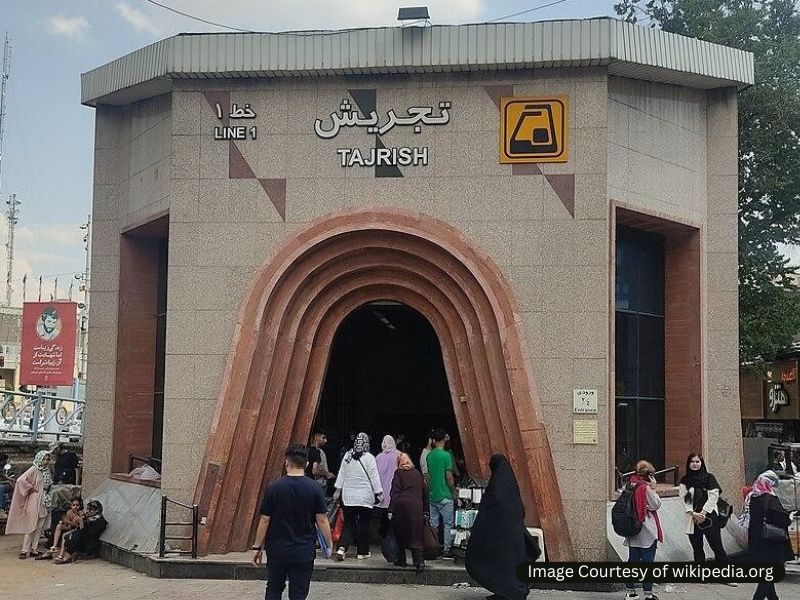
Tajrish Station is located in the affluent northern part of Tehran and is a crucial node on Line 1. It is well-known for its access to high-end shopping areas and beautiful parks.
Nearby Attractions:
- Darband: A popular hiking destination with numerous restaurants and traditional tea houses along the route.
- Tajrish Bazaar: A vibrant traditional bazaar offering local handicrafts, fresh produce, and street food.
- Sa’adabad Complex: A breathtaking historical complex with museums and gardens.
2. Imam Khomeini Station
This station is a major transportation hub, linking various metro lines and providing access to the Imam Khomeini International Airport. It’s a key starting point for travelers.
Nearby Attractions:
- Tehran Grand Bazaar: One of the oldest bazaars in Tehran, offering a labyrinth of shops selling everything from spices to jewelry.
- National Museum of Iran: Exhibits Persian history and artifacts, making it a must-visit for history enthusiasts.
3. Vali-Asr Square Station
Located in the heart of Tehran, this busy station connects to major metro lines and is surrounded by the lively atmosphere of Vali-Asr Square, a central commercial area.
Nearby Attractions:
- Vali-Asr Street: Iran’s longest street is lined with shops, cafes, and cultural venues, and it is perfect for shopping and strolling.
- Tehran’s Cultural Research Institute: A cultural hub that hosts various art exhibitions and events.
4. Milad Tower Station
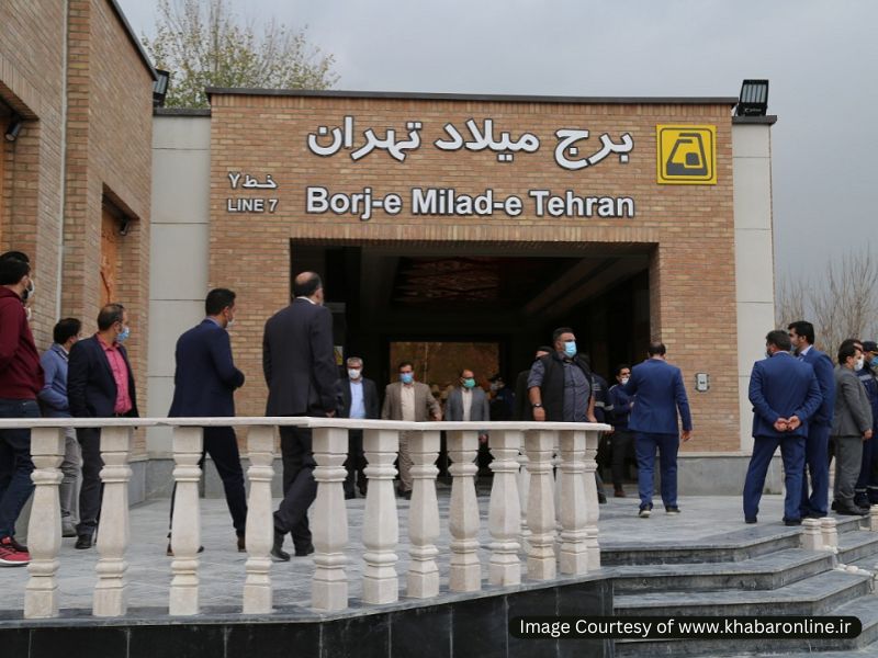
Close to the iconic Milad Tower, this station attracts many visitors looking to experience one of the tallest structures in Iran, which is also home to a hotel and restaurant.
Nearby Attractions:
- Milad Tower: Offers panoramic views of Tehran from its observation deck.
- Milad Tower Mall: A shopping and entertainment complex with various dining options.
5. Mirdamad Station
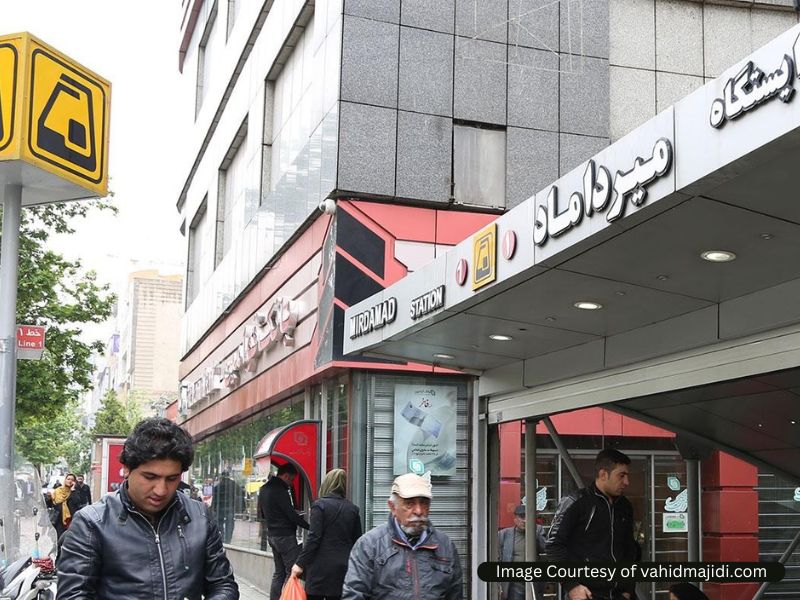
Mirdamad Station is known for its proximity to upscale neighborhoods and commercial districts, which keeps it busy throughout the day.
Nearby Attractions:
- Mirdamad Commercial Complex: A major shopping destination with various retail options and cafes.
- Shahrzad Park: A lovely park suitable for families with children.
Frequently Asked Questions about the Tehran Metro Map
If you have any other questions about the Tehran Metro or related topics, please let us know in the comments. We will respond as soon as possible.
How many stations are in the Tehran Metro system?
As of February 2025, 159 Tehran metro stations are operational across 7 lines.
How many lines are there in the Tehran Metro?
As of October 2023, the Tehran Metro has several operational lines, including Line 1 (Blue Line), Line 2 (Red Line), Line 3 (Green Line), Line 4 (Yellow Line), Line 5 (Light Blue Line), and additional lines under construction or planned for the future.
What is the coverage area of the Tehran Metro?
The Tehran Metro covers a significant part of the city and extends to various suburbs. It connects key locations such as shopping centers, business districts, and cultural sites, making it convenient for both residents and tourists.
How can I read the Tehran Metro Map?
The Tehran Metro Map typically uses color-coded lines to represent different routes. Stations are marked along each line, and interchanges between lines are indicated where applicable. It’s essential to check for the final destination when planning your route.
How do I purchase a ticket for the Tehran Metro?
Tickets can be purchased at ticket machines and counters available in metro stations. There are also rechargeable smart cards that can be used for multiple trips, which are convenient for frequent travelers.
What are the operating hours of the Tehran Metro?
Typically, the Tehran Metro operates from around 5:30 AM to 11:30 PM. However, hours may vary by line and station, so it’s advisable to check schedules posted at stations.
Is the Tehran Metro safe for travelers?
The Tehran Metro is generally considered safe for travelers. However, like in any major city, it’s advisable to remain aware of your surroundings, keep your belongings secure, and observe local customs and regulations.
How fast is the Tehran Metro train?
The average speed of the Tehran Rapid Transit system is 80 kilometers per hour. The Tehran-Karaj commuter has an average speed of 62 kilometers per hour and a maximum speed of 140 kilometers per hour. The international airport line is significantly faster, at 120 kilometers per hour.
Can I use the Tehran Metro to reach the Imam Khomeini International Airport?
Yes, Line 1 connects to the Imam Khomeini International Airport, making it convenient for travelers to access the airport directly via the metro.