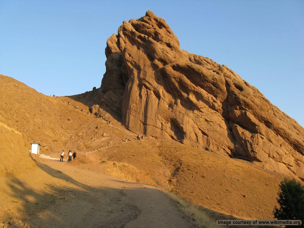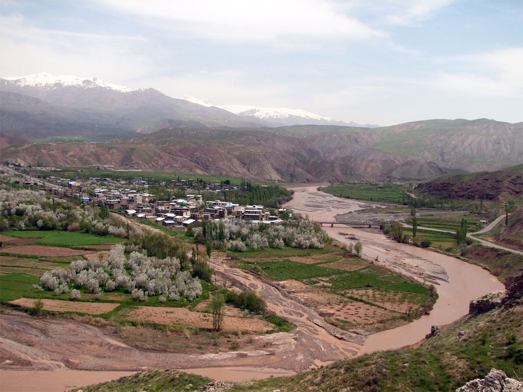
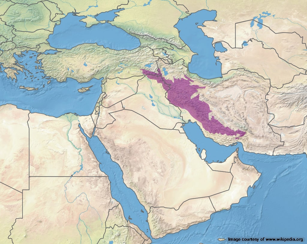
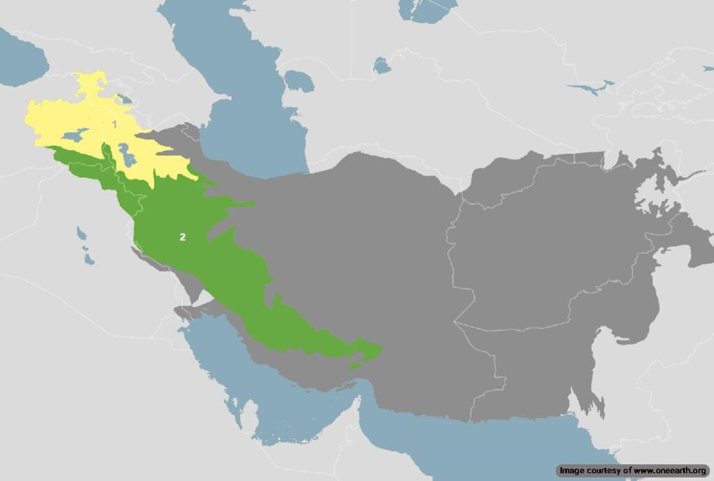
The Zagros Mountains are the longest mountain range in Iran. This mountain range is over 1600 km long, stretching from southern Turkey and northeast Iran to central and southeast Iran, under the Persian Gulf waters. This mountain range contains nearly 25,000 named peaks, ridges, and summits, making it the largest ensemble of mountains in Iran.
Geographical Map of Zagros Mountain
The following map provides an overview of the geographical diversity, rivers and vegetation, and land use of the Zagros Mountain Range.
Zagros Mountain Geological Map
The Zagros Mountain dates back to the Carboniferous period around the Cryogenian ice age nearly 800 million years ago. The map depicts the geological features of the Zagros mountain range, which extends across parts of Iran and Iraq. Key elements include:
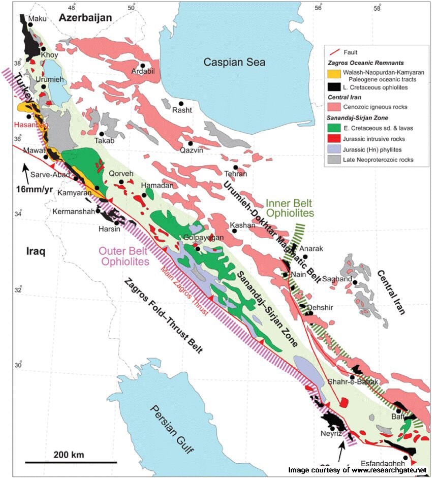
- Fault Lines: Indicated by dashed lines represent tectonic boundaries where geological activity occurs.
- Ophiolites: The map highlights both Inner and Outer Belt Ophiolites, which are sections of the Earth’s oceanic crust and underlying mantle that have been uplifted and exposed. They date back to the late Cretaceous period between 100 and 66 million years ago.
- Rock Formations: Various colors represent geological formations, including sedimentary, volcanic, and metamorphic rocks. The regions are categorized into the Cenozoic, Jurassic rocks and phyllites, and late Neoproterozoic rocks.
- Tectonic Activity: The arrows indicate the direction of tectonic movement, with rates specified (e.g., 16 mm/yr and 22 mm/yr), illustrating the annual shifts of the tectonic plates.
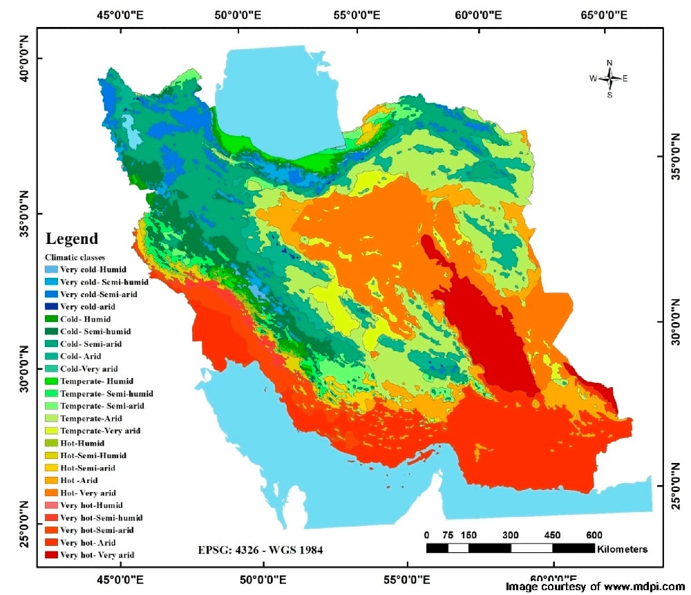
Zagros Mountain Climate Map
Precipitation
Monthly Variation: Precipitation is highest during winter, particularly from November to March, with peaks reaching around 200 mm.
Lowest Precipitation: The lowest precipitation occurs in the summer months, particularly in July and August, where it can drop to approximately 10 mm.
Temperature
Monthly Variation: The temperature shows a typical seasonal pattern, with cooler temperatures in winter and warmer temperatures in summer.
Highest Temperature: The highest average temperature occurs in July, around 30°C. The lowest average temperature is observed in January, dropping to about 5°C.
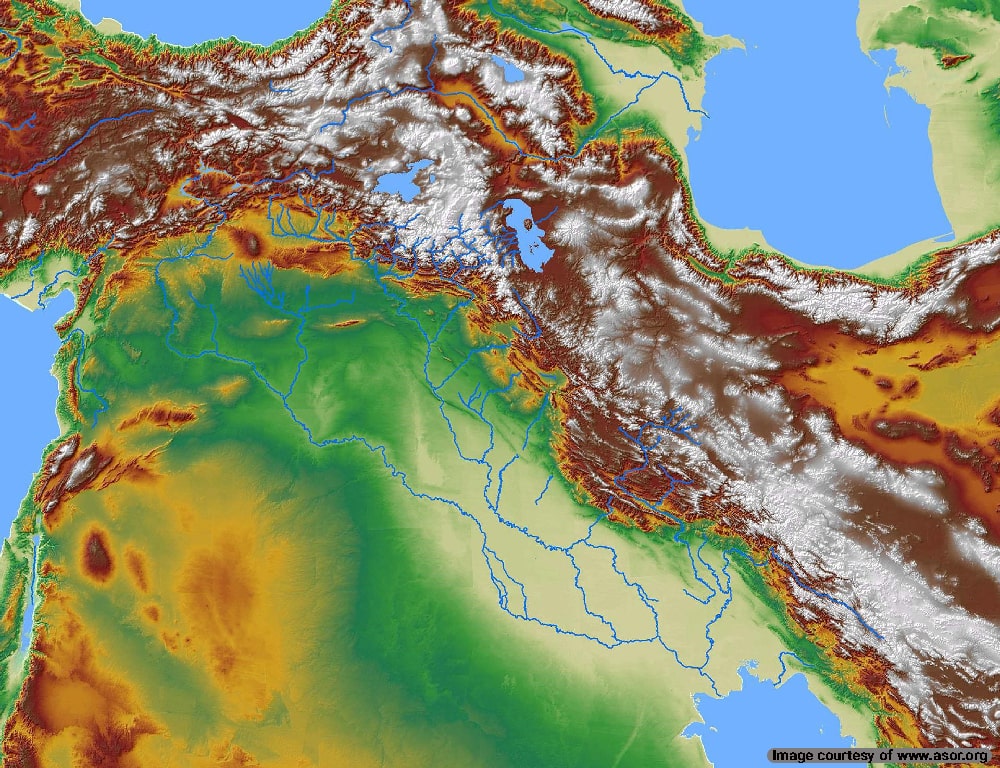
Zagros Mountain Topographic Map
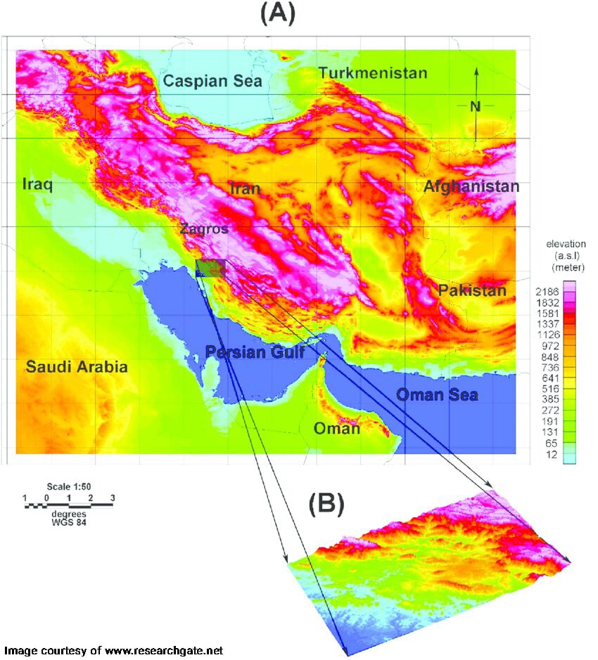
The topography of the Zagros mountain range is quite dynamic. The topography is higher in the northwest region with lower deformations. In the southeast, the topography is lower but the deformation zone is wider.
Average elevation: 3845 meters
Minimum elevation: 2692 meters
Maximum elevation: Qash-Mastan 4409 meters
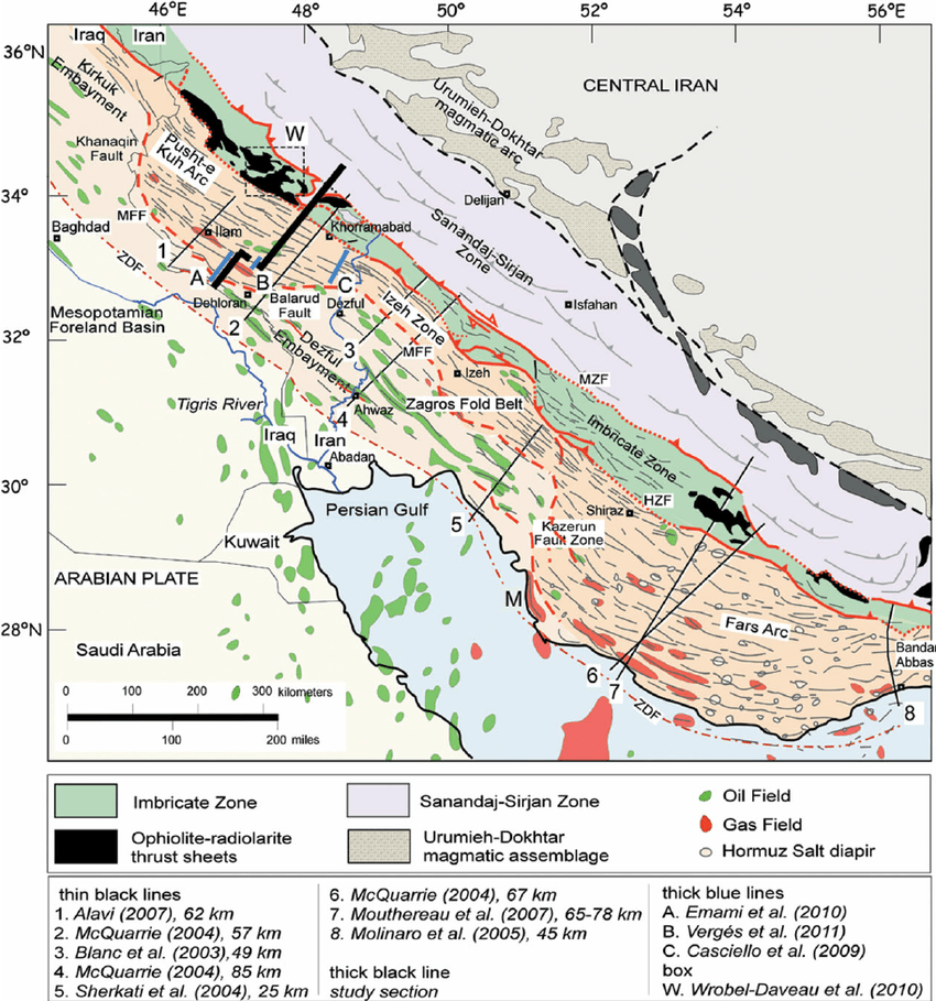
Zagros Mountain Tectonic Map
This tectonic map of the Zagros Mountains shows the shortening amount and major hydrocarbon field extents. Shifts in tectonic plates often expose underground hydrocarbon resources buried eons ago.
Hydrocarbon fields refer to underground areas that contain significant deposits of petroleum and natural gas. These fields are important as they are a major source of fossil fuels and are crucial for energy production. A black line marks the balanced cross-section. M stands for Mand anticline, and dark gray indicates the Naien-Baft ophiolites.
Zagros Mountain Flora and Fauna Map
The total Zagros steppe and forest area expanded to over 56,727,000 hectares. The Zagros forests have been subjected to deforestation and overgrazing but still contain complex biodiversity. In the past, Brant oak trees were the dominant species in the forest areas. The steppe-like areas include wild pistachio, walnuts, almonds, apricots, pomegranates, grapes, and plums. A wide range of endemic floral species are also found in the region.
The wildlife in Zagros is among Iranian endangered species such as the Luristan newt, Hamster (Calomyscus bailwardi), striped hyena, Persian fallow deer (Dama dama mesopotamica), Persian leopard (Panthera pardus tulliana), Kurdish Wild Sheep (Ovis orientalis), Eurasian Lynx (Lynx lynx), Persian Cat (Felis silvestris isis), Persian Horned Viper (Vipera ammodytes), and wild goats. In the 19th century, the Asiatic lion roamed the areas but went extinct due to hunting.
Zagros Mountain Historical Map
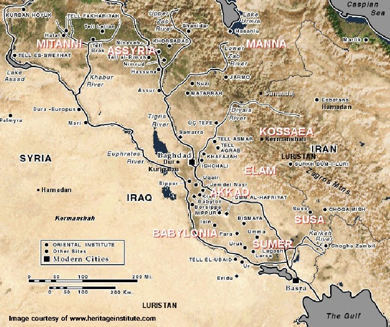
Zagros mountain range was the home of the Kassite dynasty that ruled Babylonia from 16th-12th century BCE. This nation rose to power again in the 5th century BCE and resided in present-day Hamadan, Kermanshah, and Luristan. The map above shows the borders of prehistoric civilizations in the Zagros region.
Indigenous Population of Zagros Mountains
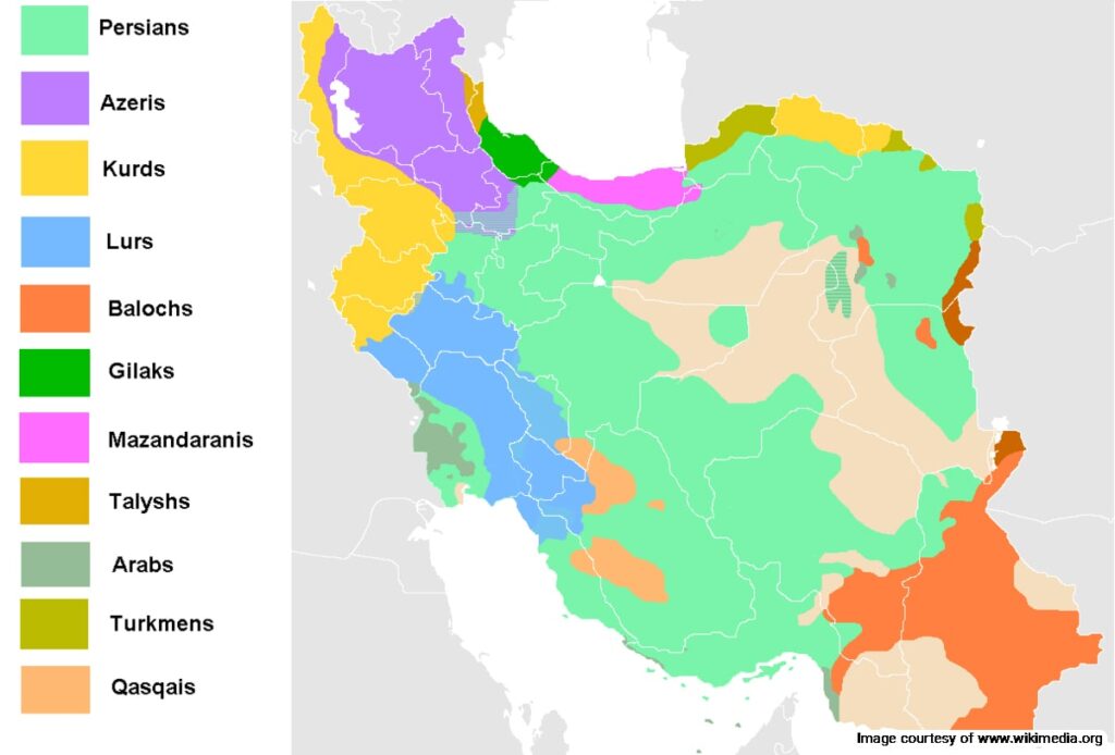
The Zagros is home to several Indigenous Iranian populations, including.
- Lurs: The Lur tribes are spread across central, western, and southern regions of the Zagros mountain range. They can be found in Lorestan, Khuzestan, Chaharmahal-Bakhtiari, Ilam, Kohgiluyeh Boyer-Ahmad, and Hamedan provinces.
- Bakhtiari: The Bakhtiari are a tribe of Lur descent who still practice a nomadic lifestyle, and rely on pastoralism to support their community. They migrate through different regions of Zagros.
- Kurds: Kurdish people are an aboriginal population that can be found across Iran, Iraq, and Turkey. They reside in high-altitude regions and practice agriculture and animal husbandry to support their community.
- Qashqai: Qashqai are a tribe of Turkic origin residing mostly in Fars province, but are scattered across Central and Southern Zagros. They speak the Oghuz language.
Learn More About Zagros Mountain Map
The Zagros mountain range is one of the most important landmarks in Iran’s geography. The mountains are home to an indigenous population, unique forest and steppe biomes, and a wide range of plant and animal species. Destination Iran aims to introduce these natural landmarks to its audience to promote the preservation of Iran’s natural resources. Make sure to follow the principles of responsible tourism if you travel to the Zagros mountains.
Where are the Zagros Mountains located?
The Zagros Mountains stretch from northwestern Iran to southeast and beneath the Persian Gulf region. In the west, it extends into parts of Iraq and southeastern Turkey.
Frequently Asked Questions about Zagros Mountain Map
If you have any other questions about the Zagros Mountain Map or other related topics, please let us know in the comments. We will respond as soon as possible.
What is the significance of the Zagros Mountains?
The Zagros Mountains are significant for their rich biodiversity, unique geology, and cultural importance. They are home to various ethnic groups and contain many important historical sites.
What are the main features of the Zagros Mountain map?
The Zagros Mountain map typically highlights the mountain ranges, valleys, rivers, and major cities located within and around the mountains, such as Kermanshah and Shiraz.
Are there any national parks or protected areas in the Zagros Mountains?
Several protected areas and national parks in the Zagros Mountains, such as the Zagros Mountain Range National Park, aim to preserve the unique flora and fauna.
What is the highest peak in the Zagros Mountains?
The highest peak in the Zagros Mountains is Qash-Mastan inthe Dena subrange, with an elevation of 4,409 meters.
What kind of wildlife can be found in the Zagros Mountains?
The Zagros Mountains are home to diverse wildlife, such as the Persian leopard, wild goat (Markhor), and various bird species.
Can I find hiking trails on a Zagros Mountain map?
Many maps will indicate popular hiking trails and routes, but detailed trail maps are often available from local guides or tourist information centers.