

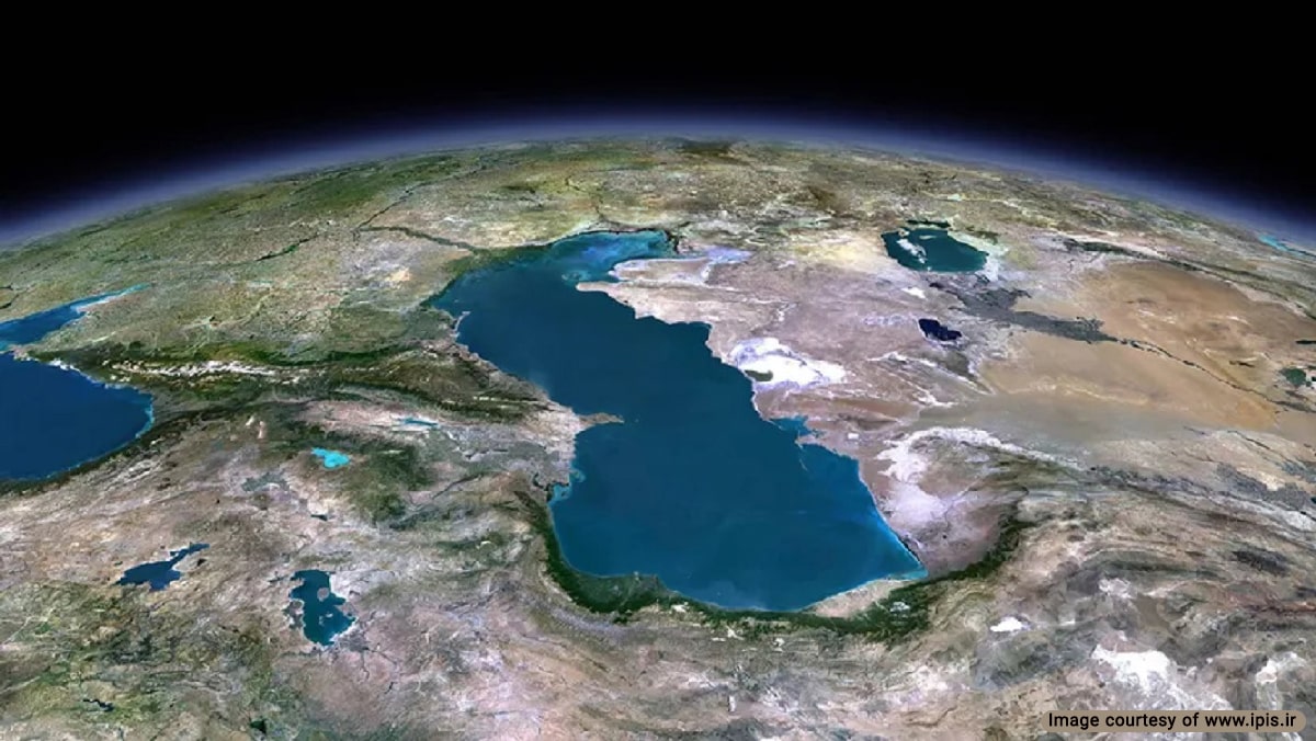
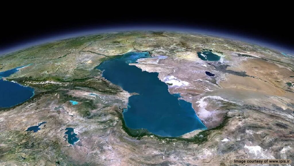
The Caspian Sea is a significant landmark in West Asia that has shaped its neighboring states’ cultural and political landscape. This blog post will explore the Caspian Sea Map from different perspectives. You can learn more about the general geography of Iran, its history of cartography, and the impact of political developments on the map.
Caspian Sea Map History of Cartography
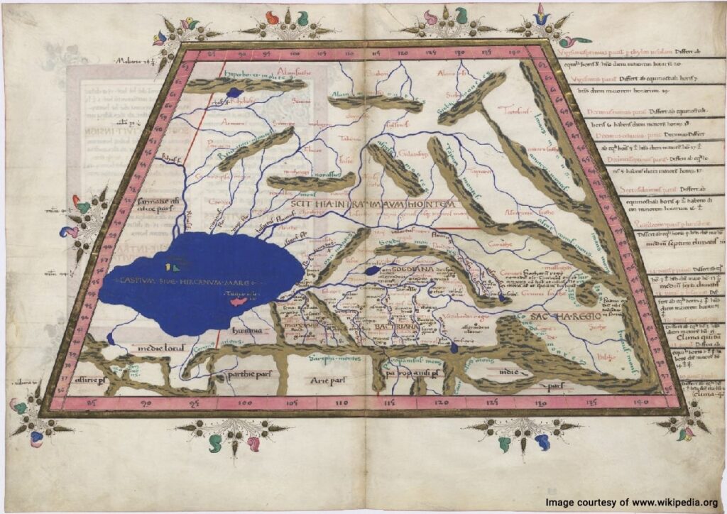
The earliest record of Caspian Sea cartography was found in Ptolemy’s Geography book from the 2nd century CE. In his 7th Asian Map, he depicts the Hyrcan Sea in the west of Central Asia. His rendering of Sogdian territories draws a more horizontal map of this body of water.
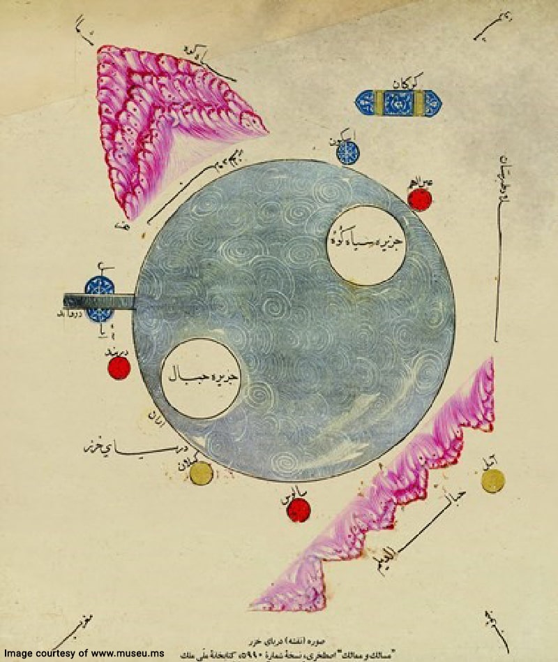
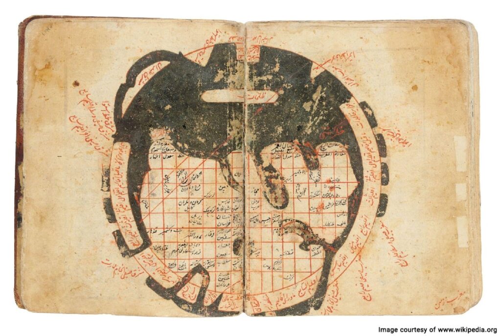
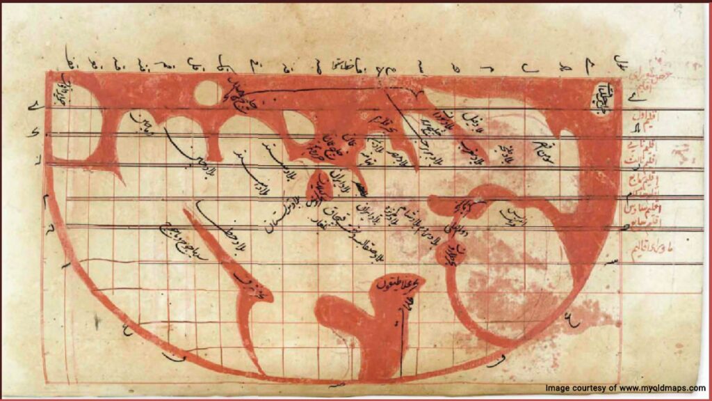
In the 9th century CE, Abu Zayd al-Balkhi (Persian Geographer and Mathematician) developed a new map of the Caspian Sea in his book Figures of the Climates (Suwar al-Aqalim). Although this map is attributed to his student, al-Istakhri, it is believed that the credit belongs to the Balkhi school of cartography.
In the 1340s CE, Hamdullah al-Mustawfi al-Qazwini created a new map of Iran in his book “Nuzhat al-Qulub” (Heart’s Bliss). This map depicts the Caspian Sea in the north of Iran. It should be noted that the available versions of this map are from the Safavid era copies of the original book.
In 1647, Sadiq Isfahani, a Persian scientist who lived in India, drew a world map that included the Caspian Sea, in the form of a triangle in the center of the map.
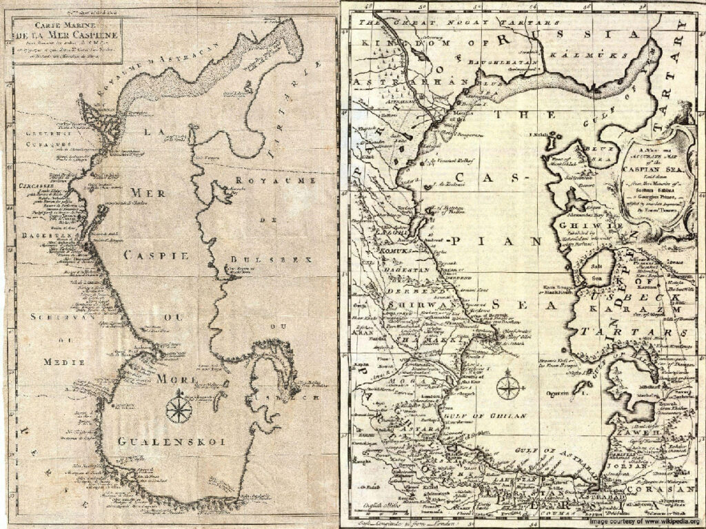
The first accurate Caspian Sea Historical Map was gathered in 1721 by Carl Van Verden (a Dutch Cartographer), sponsored by Peter the Great, a Russian Tzar to expand Russian territories. In 1748, Emanuel Bowen, the Royal Mapmaker from the Welsh, created a more accurate map of the Caspian Sea according to the memoirs of Soskam Sabbus (a Georgian Prince).
Caspian Sea Map Before and After Russo-Persian Wars
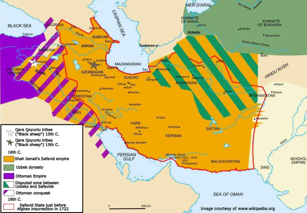
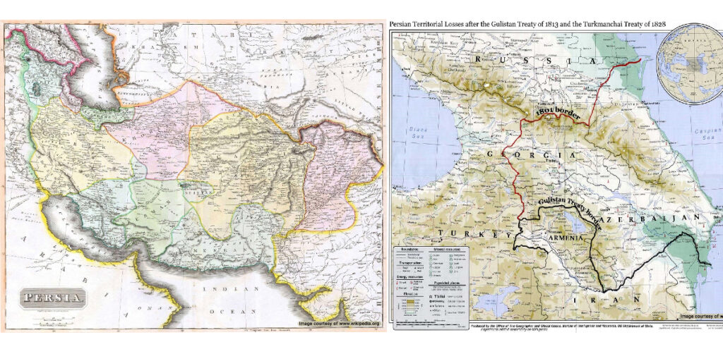
By the 19th century, the Russian Empire expanded its territory and conquered large areas in the Caspian Sea region. In two historical agreements, the 1813 Treaty of Gulistan, and the 1828 Treaty of Turkmenchay, they acquired more territory from the Qajar kingdom.
Caspian Sea Map Before and After USSR Dissolution
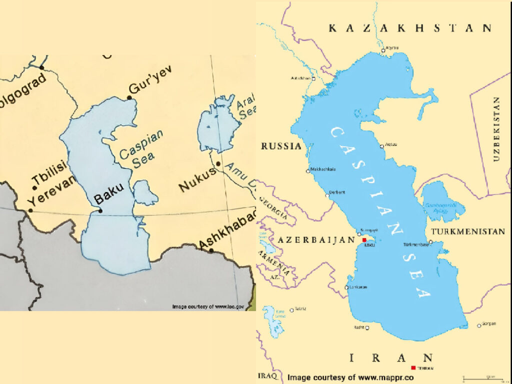
After the fall of Tsarist Russia, they nullified previous agreements in the context of the 1921 Treaty of Friendship. Before the dissolution of the Soviet Union, the Caspian Sea was divided between Iran and the USSR. Kazakh S.S.R., Azerbaijan S.S.R., and Turkmen S.S.S. were the three soviet states that bordered the Caspian Sea. Following the dissolution of the USSR in 1991, Azerbaijan, Kazakhstan, and Turkmenistan gained independence. However, their borders did not undergo any significant changes following this development.
Caspian Sea Climate Map
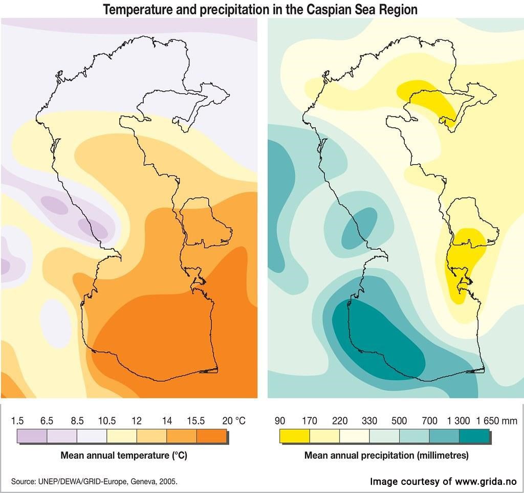
The Caspian Sea features a diverse climate from north to south, ranging from cold desert climate, cold semi-arid climate, humid continental climate, Mediterranean climate, and humid subtropical climate.
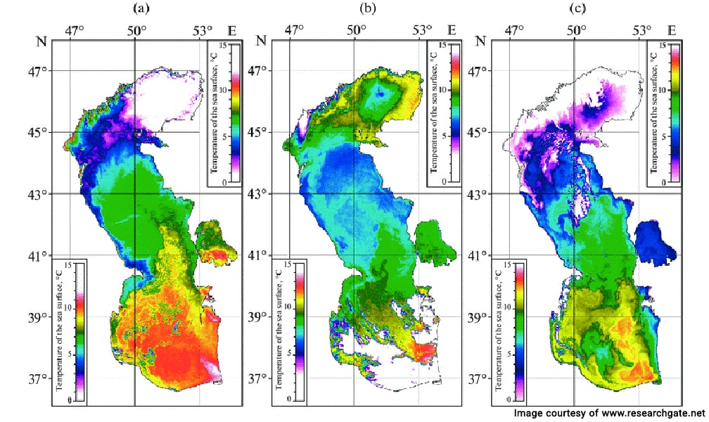
Caspian Sea Region Temperature Map
Caspian Sea Precipitation Map
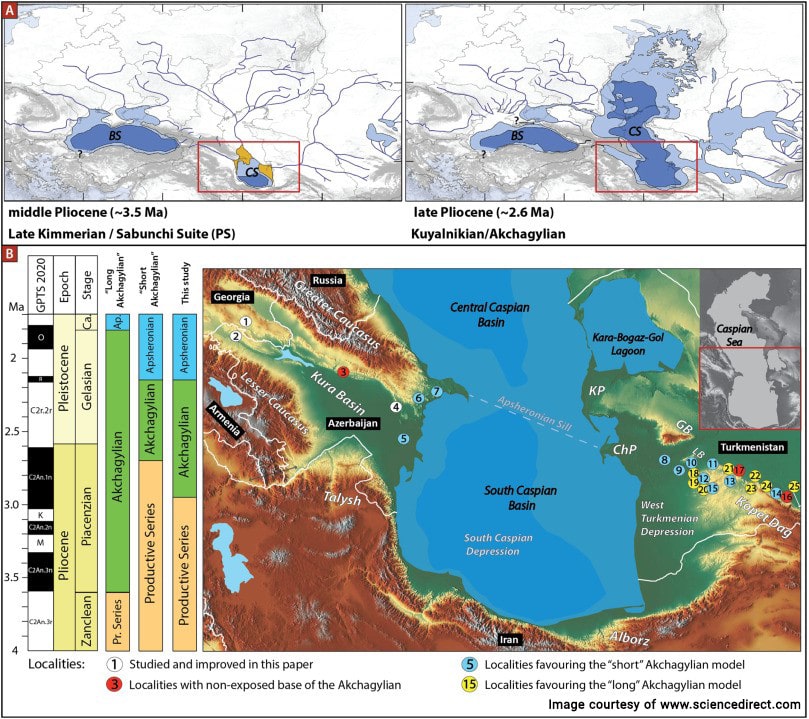
Caspian Sea Expansion During the Late Pliocene Period
3.5 million years ago, during the middle Pliocene period, the rise in temperature caused a drastic five-fold increase in the size of the Caspian Sea. By the late Pliocene period (2.6 million years ago), this body of water expanded to the north and east, and covered a large area in central Asia.
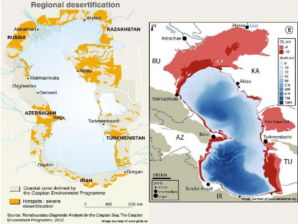
Caspian Sea Shrinkage and Desertification Map
In the past century, global warming has affected this region. Sea levels are dropping exponentially, drastically reducing the size of the sea. The desertification of the Caspian Sea is a real threat to the neighboring countries, threatening the biosphere and the endangered endemic species.
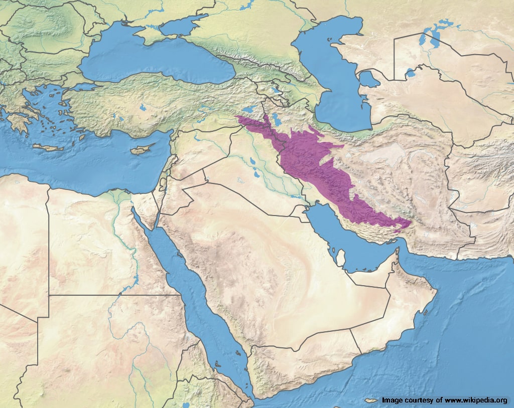
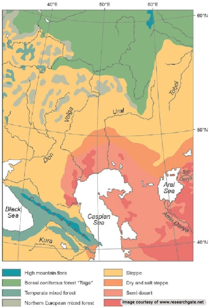
Caspian Sea Vegetation Map
The Caspian Sea features a diverse set of vegetation, from high mountain areas in the north and west to the Steppe beyond the eastern coasts.
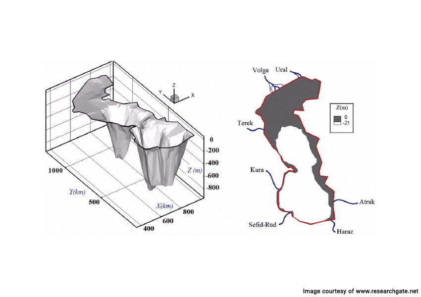
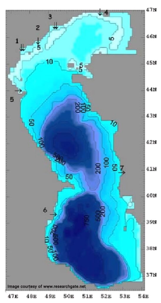
Caspian Sea Depth Map
The Caspian Sea consists of three basins with varying depths. The northern basin is the most shallow, while the central and southern basins are deeper. The Caspian Sea features the second-deepest depression on Earth that is not part of an ocean.
Caspian Sea Natural Resource Map
The Caspian region is rich in natural resources such as crude oil, natural gas, minerals and metals. The neighboring countries known as the Caspian Five have set maritime boundaries to share these natural resources under international law. This “Convention on the Legal Status of the Caspian Sea” was signed by the five countries in 2018.
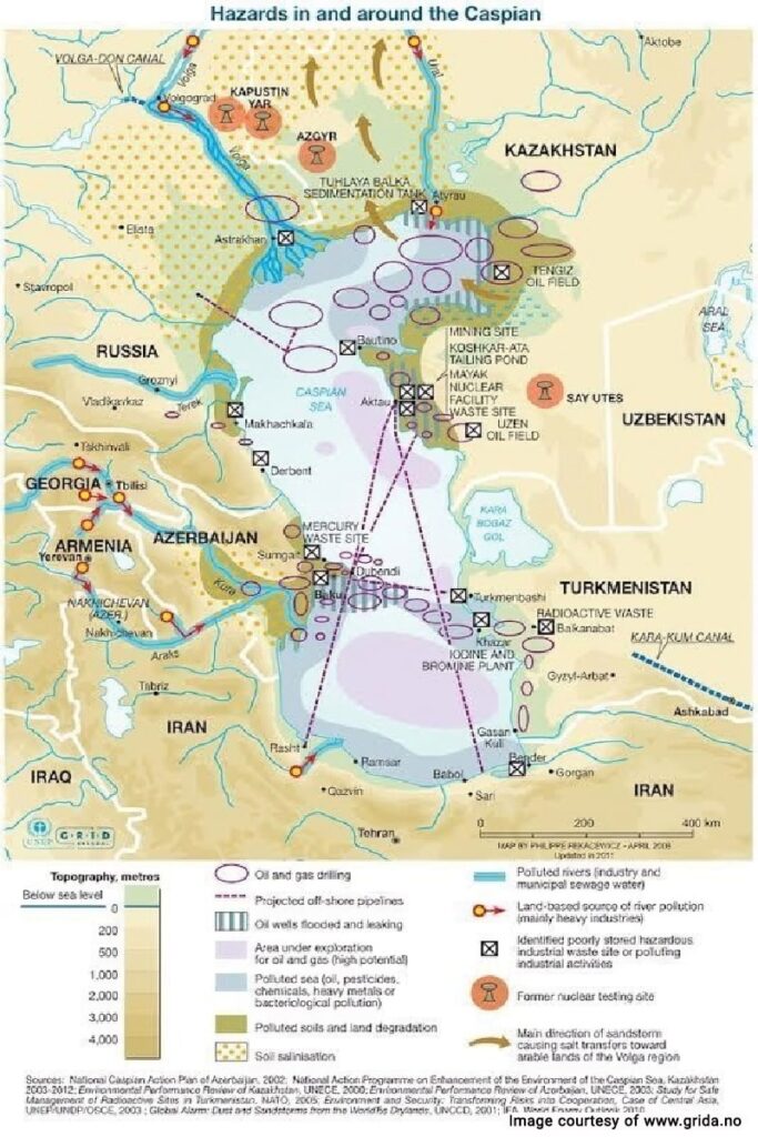
Caspian Sea Oil and Gas Export Map
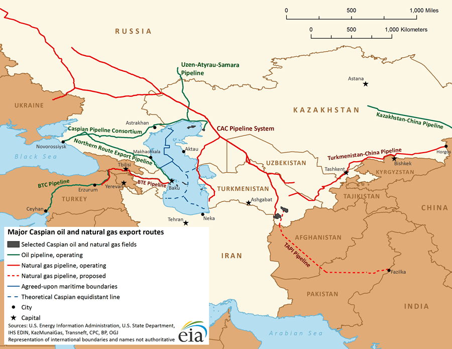
The Caspian Sea’s natural gas and oil are exported to Europe and East and South Asia markets through several pipelines.
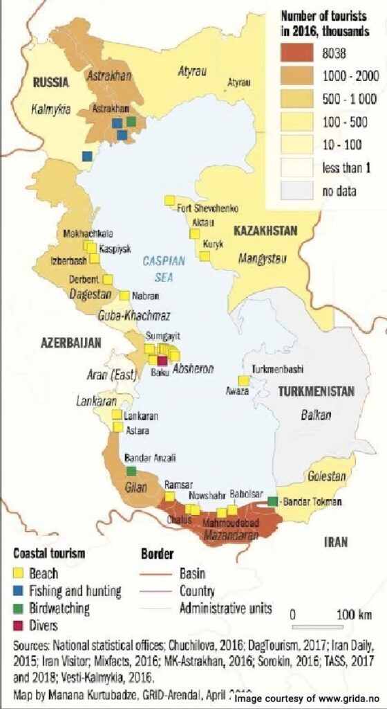
Caspian Sea Tourism Map
There are countless tourist attractions along the coasts, on the surface and in the depths of the Caspian Sea. You can check out the most popular tourist destinations in the map below.
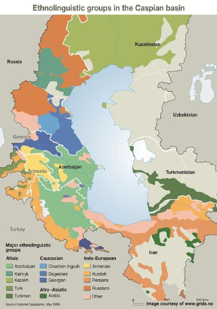
Caspian Sea Ethnolinguistic Map
There are three major ethnolinguistic groups in the Caspian basin region including Indo-European, Caucasian, Afro-Asiatic, and Altaic. It is one of the most ethnically diverse regions on Earth.
Learn More About the Caspian Sea Map
The Caspian Sea is a unique geographical landmark with a diverse biome. It features rich and extensive cultural diversity and holds a special place in Iranian history. There is a lot more to learn about this location, and you can find out more in our other blog posts about the Caspian Sea.
Where is the Caspian Sea located?
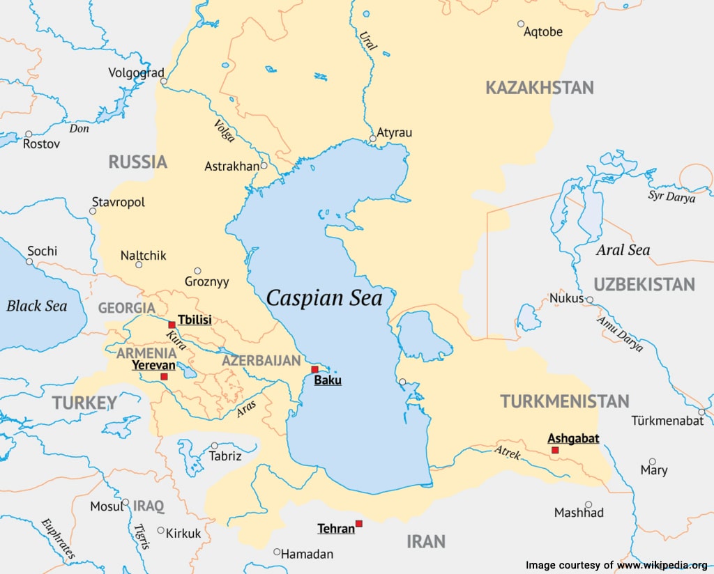
The Caspian Sea is located in western Asia and is bordered by five countries: Russia to the north, Kazakhstan to the northeast, Turkmenistan to the southeast, Iran to the south, and Azerbaijan to the west. They are known as the Caspian Five and share the natural resources per maritime laws of the Convention on the Legal Status of the Caspian Sea.
Frequently Asked Questions about the Caspian Sea Map
If you have any other questions about the Caspian Sea map or other related topics, please let us know in the comments. We will respond as soon as possible.
What are the major cities located around the Caspian Sea?
Some of the major cities around the Caspian Sea include Baku in Azerbaijan, Aktau in Kazakhstan, Astrakhan in Russia, Turkmenbashi in Turkmenistan, and Bandar Anzali in Iran.
What are the main landmarks on the Caspian Sea map?
The main landmarks include the Volga Delta, the Hyrcanian forests, the Tyuleniy Archipelago, the Absheron Archipelago, Ogurja Ada, Pirallahi and Chilov Islands, the Caspian Steppe, and more.
What is the depth of the Caspian Sea?
The Caspian Sea is quite shallow in the northern basin, with an average depth of about 5-6 meters. However, it does have some deeper areas towards the center and south, with the maximum depth reaching around 1,025 meters.
Are there any islands in the Caspian Sea?
Yes, there are several islands in the Caspian Sea, with some of the largest ones being Ogurja Ada, Chilov Island, and Ashuradeh Island. These islands are important in terms of biodiversity and the ecosystem of the Caspian Sea region.